|
||||||||
Contact |
||||||||
East: - Tervuren - Kraainem - Sterrebeek - Wezembeek-Oppem - Overijse - Wavre - Huldenberg - Bertem South: - Hoeilaart - Sint-Genesius-Rode - Lasne - Drogenbos - Linkebeek - Braine l'Alleud - Beersel - La Hulpe - Waterloo - Rixensart Brussels: - Woluwe - Etterbeek - Auderghem - Evere - Uccle - Watermael-Boitsfort - Ixelles - Saint Gilles - Koekelberg - Schaerbeek - Jette North: - Vilvoorde - Meise - Grimbergen - Machelen - Zaventem West: - Wemmel - Sint-Peters-Leeuw - Asse - Dilbeek |
 |
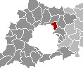
| Machelen
is an industrial and industrious Flemish community just north of
Brussels. It must be the one municipality in Belgium with the highest
percentage of land claimed by road infrastructure. It has
the E19, Ring (East), the highway to Brussels and one to the
airport of Zaventem (Leopold III Laan), all cramped
together on its 11 square kilometer. A bizarre example of this
heavy infrastructure enclosing a residential area is being foun at
Diegem-Lo. Diegem-Lo consists of a couple of streets just of the
Zaventem tarmac on one side, and with a whole set of highway fly-overs
on the other side. This sight is rated as the most interesting tourist
attraction available in Machelen. The municipality comprises Machelen proper and Diegem. The subdivision of Machelen is the more industrial part, while Diegem consists of a residential area and a huge office park. Uplace Machelen |
 |
 |
 |
| The mayor of Macchelen is socialist Jean-Pierre de Groef. |
 |
|
© 2008 Estaval |